

How do we track migrating birds?
Being able to state, with certainty, where birds migrate to is a relatively new science. Until recently, researchers had little idea where many species moved to. Now, the information is more joined up and a bird’s worldwide ranging area can be monitored and protected.
Knowing bird moments, together with the routes they take, enables communities to safeguard birds at both ends of their journey. There are low and high-tech ways of tracking birds to see where they end up. The main proviso is that the method used must not compromise the survival of the bird. In this article, Ranger Julie takes a look at the different methods used and how you can help.
Ringing
This is a very low-tech way of being able to note where birds are seen. As with all tracking techniques, it has both its positive and negative points.
Ringing is a cheap and long-term option for monitoring bird movements. The rings themselves cost a matter of pennies each, although it is high on personnel needs and is a labour-intensive team exercise. It requires individuals to net, catch, hold, measure, log data, and finally ring and release birds. However, as it allows people legally to handle birds, and see them up close, it’s not the most difficult thing to recruit volunteers for. Many ringing teams are made up of long-serving members and it is one of the more rewarding citizen science projects.
To be part of the team who physically add the rings you do need to be specially trained or closely supervised. It is illegal to handle certain species without holding a ‘Schedule 1’ licence. This ensures that birds are not mishandled, unduly disturbed, damaged or their survival compromised, during the ringing process, or because of it.
Local organisations which regularly ring are:
East Kent Wildlife Group https://www.ekwg.org/ringing
Swale Wader Group http://www.swalewaders.co.uk/
Nationally, ringing is managed by the British Trust for Ornithology: https://www.bto.org/our-science/projects/ringing
The Wader Study Group covers a wider, international, ringing area: https://www.waderstudygroup.org/
What kind of birds are ringed?
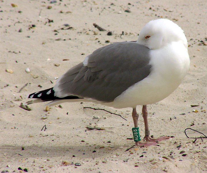
Herring Gull Credit Andreas Trepte, CC BY-SA 2.5
Ringing is best for birds whose migration route is already known. The data gathered from ringed sightings can allow for better habitat preservation. Specific feeding and nesting areas can be pinpointed with more precision. Inland birds are a suitable subject for this technique, as are birds which undertake a regular, predictable migration from one specific land mass to another. This regular return to the original breeding site is known as ‘site fidelity’ or being philopatric.
What have been the success projects for ringing?
A great example of a ringing project, which has yielded really useful data, has focused on Godwit, a type of wader. Project Godwit, based in the Nene and Ouse Wash, East Anglia, working with Black-tailed Godwit has been responsible for ringing birds. Their chicks are helped using a technique known as ‘headstarting’. The researchers start by collecting eggs (under licence) from the wild and hatch them in a controlled setting indoors. When released, the chicks have a much better chance of survival, as a result of receiving optimum nutrition. Also, they do not have to deal with predation and they can be ringed in a stress-free manner. As these chicks will carry rings for their entire life, this gives the researchers the potential to collect long-term data.
Researchers at Project Godwit hoped that, as with wild hatched chicks, the birds would migrate away in autumn. Then, the following spring, return to where they were laid. This would be an ideal outcome for the project, as it would prove a long-held theory about Godwit movement. Follow what happened next with the surprising story of Remi the Black-tail. She didn’t quite end up where she was expected… Tracking of her movements was only made possible by ringing. https://wadertales.wordpress.com/2018/05/21/site-fidelity-in-black-tailed-godwits/
What ringing does and how you can help…
As a walker on the coast, you can help if you find a dead bird which is ringed. Option one is to remove the ring, ensuring that any numbers on the ring are not broken off. It can then be sent to the BTO, with exact details of when and where you found the bird. Alternatively, you can enter the details yourself on this link.
https://www.bto.org/our-science/projects/ringing/about-ringing/why-report-ringed-bird
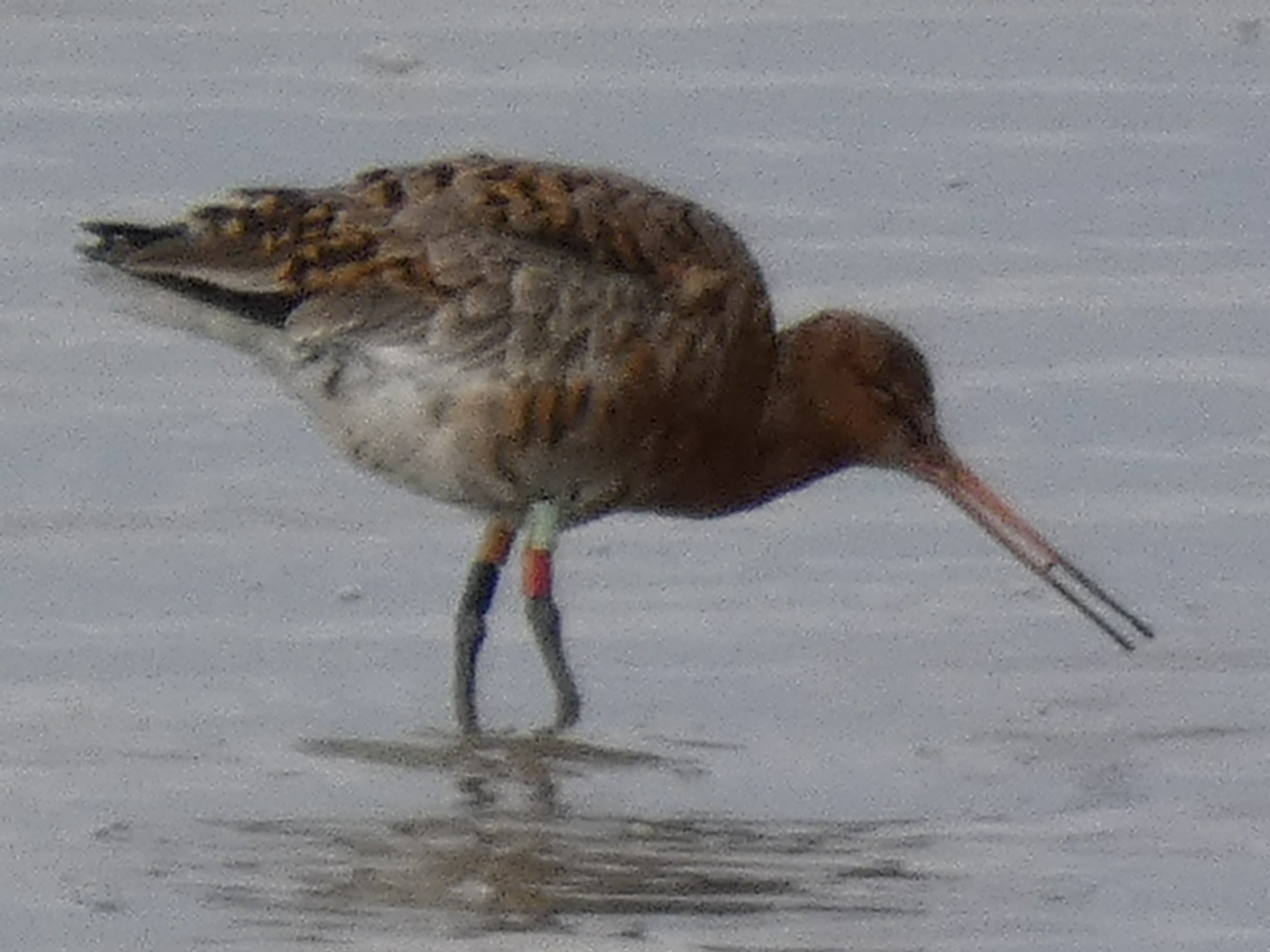
Black Tailed Godwit feeding on the Medway with multiple colour rings
The ring will provide information on where and when the bird was initially ringed. Some species carry multiple rings, indicating recapture during their travels. So, it’s important to make a note of which leg the colours were on and what order the rings were stacked. From this, researchers can begin to work out how far specific species travel and how long they can live. Unlike more high-tech solutions for tracking, a ring seldom drops off and doesn’t decay or stop working. It can even give useful information if it has been washing around in the ocean for a while before making landfall. As only one in fifty rings are ever recovered from dead birds, it is really helpful to pass this information on to the right research team, using the above link.
For larger, wading birds, the rings are easily visible, normally on the leg, above the knee.
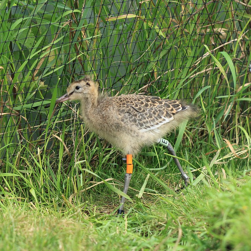
Credit: Project Godwit
This is an image of a ‘Project Godwit’ bird. Their specific marker is a lime-coloured ring on the right leg, stamped with an ‘E’. If you are lucky enough to see any ‘E’ marked birds, use the link below.
https://projectgodwit.org.uk/get-involved/report-a-sighting/
The problem with rings is that they only give a very brief snapshot of where a bird has been. There is no data in between these sightings. Although, taking into consideration last known habitat, a rough transit route can be estimated.
As you can see, physically ringing the bird is only the start of a project. Schemes are totally reliant on the assistance of keen, observant birders who know how to report sightings.
Remote tracking
Birds were first tracked using satellite systems over thirty years ago. At that time the hardware was so large that only the biggest birds could carry it safely without it compromising their survival rate. The albatross was therefore the first bird whose previously unknown wanderings were discovered.
There are several types of remote tracking systems. The Global Positioning System of satellites enables a bird to be tagged with a GPS transponder. This gives out a locating signal anywhere in the world. Alternatively, the Global System for Mobile Communications (GSM) can be used, which links with mobile phone mast technology. Even good old VHF radio signals can be utilised for the lowest tech tracking.
How the technology works
GPS signals can be picked up by any one of more than thirty navigation satellites circling Earth. The tracker signal is then triangulated using three or more satellites. This allows the position of the bird carrying the tracker to be pinpointed within a few metres.
This type of hardware tends to be fitted to larger birds as a back mounted pack. It is the battery which makes it large, rather than the transmission technology. They are carried by the bird either glued to feather or on a harness. Harnessed birds are often tagged just before they leave for migration, tracked en route and the pack is recovered from the bird when they reach their final destination. It’s not an ideal way of working, as it involves the bird undergoing two catch and release episodes. However, the harness does ensure that the expensive tracker tends to stay on the bird and is not irrecoverably lost.
Birds with glued trackers tend to preen the tracker free or it drops off naturally at feather moult. Glued can be better for the birds, as only a single initial capture is required. This blog by Wadertales on Spoon Billed Sandpipers has a really good image to show how tiny the trackers are Spoon-billed Sandpipers: Track and Trace | wadertales (wordpress.com)
Extra things to add
Tracking technology is becoming more and more sophisticated. You can now add in other parameters to monitor, such as acceleration and deceleration in flight speeds, or the device’s orientation and rotation. The most exciting new toy for researchers of migration is the miniaturisation of magnetometers. They sense the earths magnetic field and help scientists assess if magnetism is a guiding factor in long distance bird movement.
Most data is published as two-dimensional maps as part of a printed research paper when the information is released to the public. However, often the data can be plotted in three dimensions. This will show not just linear progression, from continent to continent, but also the height of flight paths. It can also indicate the increase and decrease of flight speeds and temporary stopping off points en route.
Smaller and smaller…
Tracking technology is now truly miniaturised with newer techniques such as Geolocators, which work by sensing light. As well as Argos Platform Transmitter Terminals (APTTs) which generate a snap fix on a single satellite when, rather than the power heavy triangulation of the GPS transmitters.
How long does a tracker last?
How long a tracker lasts depends on environmental factors, such as water and weather taking their toll on the hardware. Physically, most trackers can work for about three years. However, the average project doesn’t get that length of data. How to keep the tracker powered up is the main challenge. If the battery is large enough to last three years, it is too heavy for many bird species to carry. Newer trackers are now supplementing battery power with solar recharging. It means the tracker may cease to work temporarily in dull weather, but it means that weight is reduced.
Accessing the data
Data, from trackers, can be accessed in two ways. The tracker can be removed from the bird, plugged into a computer and all data downloaded in bulk. That can be frustrating if the bird goes missing and the tracker can’t be retrieved. The researcher ends up with nothing. Other trackers can periodically establish a satellite link and upload data in the field.
Want to know more?
For a fascinating rundown on the latest developments and application of tracking technology, read this article by Phil Atkinson, Head of International Research & Principal Ecologist, BTO.
If you love looking at maps and just seeing where birds go, try this website. It contains fascinating data on 132 different species.
http://seabirdtracking.org/mapper/