

February 2nd is World Wetlands Day, an international celebration of this amazing habitat across the globe. But what exactly is a wetland? Ranger Julie takes a look at the wonderful world of wetlands in this weeks blog.
What’s so special about marshes?
We are so lucky on the Medway, Swale and Lower Thames corridor; our rivers and coasts have marshy edges. In other areas building work, over the centuries, has encroached on the water’s edge, resulting in rivers and coastal areas being bordered by concrete edges. When this happens, the river flow and water’s depth artificially prevent low land areas being flooded and becoming marsh land. This means that aquatic birds and mammals lose precious feeding area.
Whilst Medway, Swale and the Thames aren’t totally untouched by development, we still have large pockets of these marshlands. These are so special they have been given international ecological status. They are Ramsar Sites.
Ramsar sites… Never heard of them?
 Ramsar sites are detailed on the ‘List of Wetlands of International Importance’ established in 1971 to help safeguard this type of habitat. They are named after an area in Iran, where the agreement was signed by the countries which founded the list. The areas listed were identified as being important for future species conservation. UK sites joined the list in 1976.
According to the founding principles of the Ramsar convention, not only are our marshes important for the birds but also ‘for humanity as a whole.’ The list is the world’s largest network of protected natural habitats. Medway, Swale and the Thames Estuary are therefore part of an enormous worldwide collection of over 2.5 million square kilometres of wetlands.
You can explore the online Ramsar site here, country by country: https://www.ramsar.org/country-profiles
How to find a local Ramsar Site.
Well, if you love watching waders and ducks, it can make birding easy if you know where to find a Ramsar site. There is a helpful interactive map here https://rsis.ramsar.org/ris/645
As you can see, the listed area is outlined in a lovely blue shade, this indicates that a really important marshland area is present. You can zoom right in and check where your nearest site is. Zoom out, and you will see orange dots appear on other parts of the map. Click on those and the other site maps appear with marsh areas demarcated in blue. Click on the ‘Downloads’ tab, to the right, next to the ‘Overview’ tab, and you can print out a sheet to take with you. This lists the special plants, birds and animals to be found in the area. You’ll also find a link to a detailed printable map.
These blue mapped areas are irreplaceable habitats of word class quality. Think you have to go abroad to safari to see rare bird life? Think again. Out of over 2,400 Ramsar sites worldwide, the UK has more than any other country at 175. We’re on the same list as the Camargue in France, the Amazon Basin and Mangrove swamps, Brazil and the Zambezi Delta, Mozambique.
What habit can we find on our sites?
 The blanket term of ‘marsh’ is really too general to describe the diverse range of habitat which we have on our doorstep. According to the Ramsar list we have: ‘a complex of rain-fed, brackish, floodplain grazing marsh with ditches.’ As well as ‘saline lagoons and intertidal salt marsh and mudflat’, topped off with ‘freshwater grazing marsh, an estuarine channel, and areas of shingle, shell and sand beaches.’
That’s a lot of land and water interacting, to give a refuge for our overwintering birds to rest and feed on.
What do these habitats consist of?
They are each very different and provide very specific feeding, growing and roosting areas for specialised animals, plants and birds.
Brackish water: This is also sometimes known as ‘brack water’. It’s a natural phenomenon where flowing or standing water, in a coastal area, contains more salt than fresh water, but less than sea water. Medway brackish waters have a concentration of salt between 5 – 30%. The average sea water content is 34.7%.
Brackish water occurs in the Thames and Medway estuaries. It can be found where fresh water, flowing from the mainland rivers, mixes with tidal sea water, which contains saline. Brackish water can run a surprisingly long way inland. For example, the Thames estuary is brackish between Gravesend, where Bird Wise rangers start their patrols, and goes upriver towards London, petering out around Battersea.
 Grazing marsh with ditches: This kind of environment can be seen at Cliffe Pools, amongst other sites. For the farmers, whose stock graze the land, the ditches act as a watery fence to keep animals in the correct area. They also ensure that land does not get too waterlogged or too dried out. It’s estimated by the Medway Swale Estuary partnership, who Bird Wise is partners with, that in our area has over 1,200 miles of ditching. You will often see large bird such as egrets and heron fishing in these waters. They are a little too deep for your average wader, who prefers the grazing land itself.
Grazing marshes split into two types:
Flood plain grazing marshes are regularly flooded by brackish water. The ditches acting as a runoff area for surplus water. This ensures that the ground does not become too waterlogged, which would cause salt levels to rise to unmanageable levels.
Fresh water grazing marshes. Here, the grass is irrigated by a fresh water source, such as a stream, or even water rising in the surrounding ditches themselves. Once the flash flood is over, the water subsides into the ditch.
The grass which these ditches surround provides an ideal habitat for wading birds to rest and feed on. You can see them when the tide is in and the mudflats are covered, preventing feeding out on the estuary. Look out for curlew and godwit, these, together with oystercatchers and lapwing. These birds are looking for worms, and other invertebrates. Shelduck and geese will often join them, feeding on the grass itself. The grass, because of the moisture, grows well, whilst stock grazing keeps it short enough for smaller birds to feel comfortable when on the ground. That’s because they can see over the sward. In spring, many waders and ducks will nest there as well.
 Saline lagoons: Saline lagoons are lakes filled with salty rather than fresh water. Again, the salt concentration gives a brackish quality to the water content and can run up to about 30% salinity. This habitat provides a sheltered home from home to seashore birds inland. Idea if the weather is bad on the coast.
Tide dominated estuarine channel: Estuarine areas are wide river mouths where tributaries join the sea. As you follow the estuary inland, up stream, they narrow. The wide area at the entrance has a large expanse of mud. This is exposed for a significant length of times between tides, as we have very strong tides, twice every twenty-four hours. They are, as a result, perfect feeding grounds for coastal birds. Sediment, dropped in the area by the river, adds significantly to the nutrients of the site.
 Mudflats: These are found in the intertidal zone, situated between the high and low tide lines. The majority of our Ramsar site ecosystem is mud, which supports thousands of birds. The only plant which grows in this region is eelgrass. This is so robust that it is the only plant in UK waters capable of living within the zone and flowering there. It is this which sustains our visiting winter population of brent geese.
A single square metre of estuary mud contains the energy equivalent of sixteen chocolate bars. This is provided to our waders, ducks and geese in the form of mud burrowing invertebrates. So, next time someone says that the coast is boring, once the tide is out, tell them how crucially important that mud is to life on earth.
Intertidal salt marsh: There are several types of salt marsh. Ours are intertidal, between the high and low tide mark. This is the part of the marsh which is regularly flooded, and revealed twice a day, every day. The green plants growing in this area need to be very resilient. They must tolerate fluctuating water levels and differing concentrations of salt. This area is also locally referred to as ‘saltings’.
These salt marshes are created over time from the natural evolution of mudflats. Sediment is deposited on mudflats from estuarine flow. The fresh water, coming down through mainland, drops the mud it is carrying before it flows out to sea. Alternatively, the area is built up by silt coming in on the tide. These deposits of silt and soil raise the level of the mud creating areas which are not fully covered by water on every hight tide. Plants gradually move into these high spots, which are capable of managing the daily changes in environment, as the tide advances and retreats. Their roots hold the silt in place. This obstruction slows down the flow of water, which results in more and more silt being deposited by the passing water. Eventually after many, many years the mudflats evolve into solid ground.
We can see this kind of marsh at Riverside Country Park, Gillingham. They run alongside the paths from the visitors’ centre as you head towards Bloors Wharf.
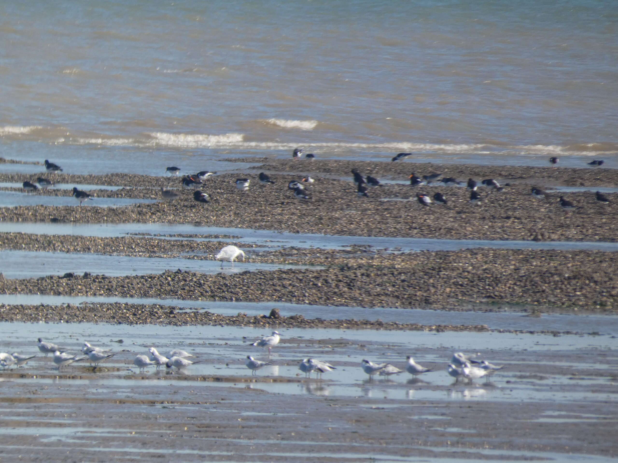 Shingle, shell and sand beaches: You can see great examples of these on the Isle of Sheppey if you walk from Leysdown to Shellness. This route will take you effortlessly from sand to shingle, then onto shell beach. They merge seamlessly together. Which type of beach you get in an area depends upon sea currents and weather fronts.
Sand is formed from rocks, shells and fossils which have been ground up other thousands of years, by the action of the sea and tide. It is finer than gravel but coarser than silt. Its colour and feel depends upon what rocks it is created from.
Concrete can only be made from sea sand; desert sand won’t do. Sea sand extraction takes place along our coast. However, because sea sand takes so long to create, it cannot be replaced in our lifetimes. This is why it is illegal to remove any natural material, including sand, shells and pebbles from public beaches in the UK, under the Coastal Protection Act 1949. You can be fined up to £1,000.
Shingle is a collection of pebbles which form the surface and underlying strata of a beach. It is a graded surface ranging from 2 to 200 millimetres in diameter. For the geologists amongst you, it also has cobbles, these are larger than pebbles, but smaller than boulders, at 64 to 256 millimetres in diameter.
Shells are the protective outer covering of molluscs. They are generally created from calcium carbonate, called nacre. This chemical is taken in by the mollusc who excretes it to form their home. As the mollusc grows, so does the shell to accommodate it.
The loose shells forming beaches are from dead molluscs and are usually empty. Be careful though, crabs can move into empty shells for protection, if the size is right.
Celebrate Ramsar Day…
On 2 February every year we have International Ramsar Day, ‘Raising public awareness of the values and benefits of wetlands.’ This year’s theme is ‘water, wetlands and life’ focusing on how all three are inseparable.
Check out the official page to read some inspiring stories from around the world. https://www.worldwetlandsday.org/
You can also find downloadable resources for your students if you are a teacher, or you want a lovely marshy poster to hang, or a memory game to play…